| Do you at all know Bora
Bora? No? Well, how about Tahiti? Now, you do know that? Great! Next question:
Where exactly is Tahiti? Now, to solve that question we have a map at hand:
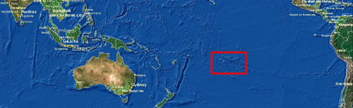
Click the red rectangle for a closer look!
As you can see above, Tahiti and Bora Bora - both a part of
French Polynesia - are about halfway between Australia and South America. When
coming from the western hemisphere, you normally will come in by plane via Los
Angeles and/or Honululu. Air France and Air New Zealand fly that route
frequently.
But, Tahiti is only one link in a gleaming chain of five
archipelagos with 118 islands scattered like jewels over an area the size of
Europe: the Society Islands, Austral Islands,
Marquesas Islands, Tuamotu atolls and the Gambier Islands.
The Tuamotu Archipelago to the east of Society
archipelago is the largest of all with a surface of 1.800 sq. km. It consists
of 80 atolls which are ring shaped coral islands surrounding a lagoon. Rangiroa
is the widest atoll of this archipelago and those of Manihi , Fakarava, Anaa,
Kaukura, Taaroa and Tikehau are the main ones.
The Austral Archipelago consist of 5 high islands south
of Tahiti with a distance of 160 to 230 km separating them. These high islands
with a sharp mountainous relief are surrounded by a coral reef either at the
coast level itself (fringing reef) or at the ocean level (barrier reef). The
farthest island from Tahiti, Rapa is 1500 km from Papeete.
The Marquesas Archipelago is located 1500 km north-east
from Tahiti and consists of 9 islands with hilly relief.
The Gambier Archipelago extends towards the southwest
of the Tuamotu archipelago and has about ten small high islands.
The finally the Society Archipelago is itself divided up in 2
parts:
- the "Windward Islands", consisting of 4 high
islands including Tahiti or "Love Island" ( itself divided into 2
islands,Tahiti Nui the large one, and Tahiti Iti, the small one), Moorea and
Tetiaora.
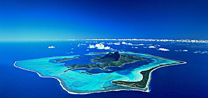
- the "Leeward Islands", 200 km from Tahiti, include
Huahine, Raiatea, Tahaa, Maupiti and Bora Bora.
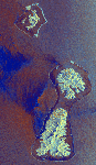
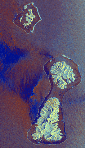
Satellite view (click to enlarge),
Bora Bora in the north and Raiatea in the south
with Tahaa in the middle.
Together the 35 islands and 83 atolls of French Polynesia
total only 3,543 square km in land area, yet they're scattered over 5,030,000
square km of the southeastern Pacific, from the Cook Is. in the west to Pitcairn
in the east.
There's a wonderful geological diversity to these islands. From the dramatic, jagged volcanic
outlines of the Society and Marquesas islands to the 400-meter-high hills of the
Australs and Gambiers and the low coral atolls of the Tuamotus.
All of the Marquesas are volcanic islands, while the Tuamotus
are all coral islands or atolls. The Societies and Gambiers include both
volcanic and coral types.
Tahiti, just over 4,000 km from both Auckland and Honolulu, is
not only the best known and most populous of the islands, but also the largest
(1,045 square km) and highest (2,241 meters). Bora Bora and Maupiti are noted
for their combination of high volcanic peaks within low coral rings. Rangiroa is
one of the world's largest coral atolls while Makatea is an uplifted atoll. In
the Marquesas, precipitous and sharply crenelated mountains rise hundreds of
meters, with craggy peaks, razor-back ridges, plummeting waterfalls, deep
fertile valleys, and dark broken coastlines pounded by surf. Compare them to the
pencil-thin strips of yellow reefs, green vegetation, and white beaches
enclosing the transparent Tuamotu lagoons.
In all, French Polynesia offers some of the most varied and
spectacular scenery of the entire Pacific islands region.

|